The CWS App

The trip planner that goes where the signal dies.

Plan smarter, travel safer, come home with skills worth keeping. Offline satellite maps, live weather, USGS river gauges, GPS tracking, and an AI Coach that knows your route. Built for people who actually go.

Included with membership  ·  works offline  ·  live USGS gauges  ·  no ads, ever
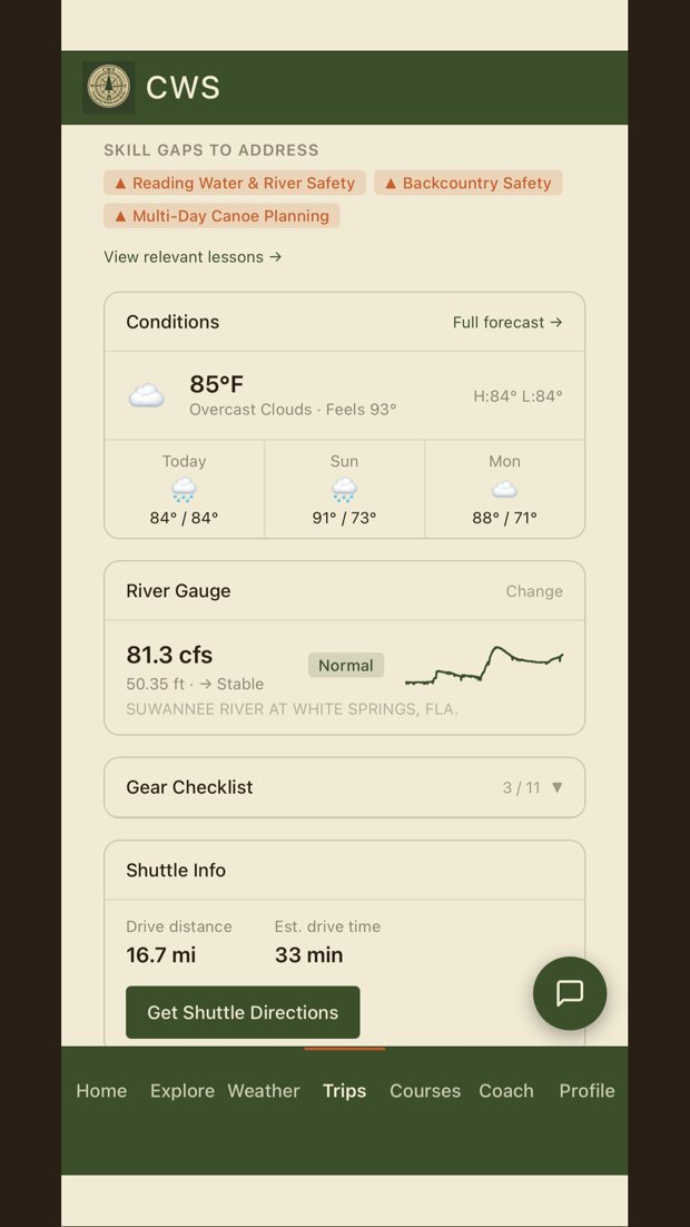
CWS app trip plan showing skill gaps, river gauge, and shuttle info

In short: The CWS app is a trip-planning tool for hikers and paddlers. A guided intake builds a plan around your actual skill gaps, then backs it with offline satellite maps, weather refreshed every 15 minutes, live USGS river gauges, and GPS tracking with an emergency-contact check-in. Premium adds the AI Coach, unlimited trips, and offline downloads for any region. It's included with CWS Premium and available on iOS and Android.

What makes it different

Skill-gap planning

A plan built for you, not a generic checklist

Answer a guided set of questions about your route, group, gear, and experience, and CWS builds a personalized trip plan that flags your actual skill gaps before they become emergencies. Weather, water level, gear, and shuttle logistics, all in one place.

Trip plan with skill gaps to address and river gauge
Maps & GPS

Satellite maps and GPS tracking that work offline

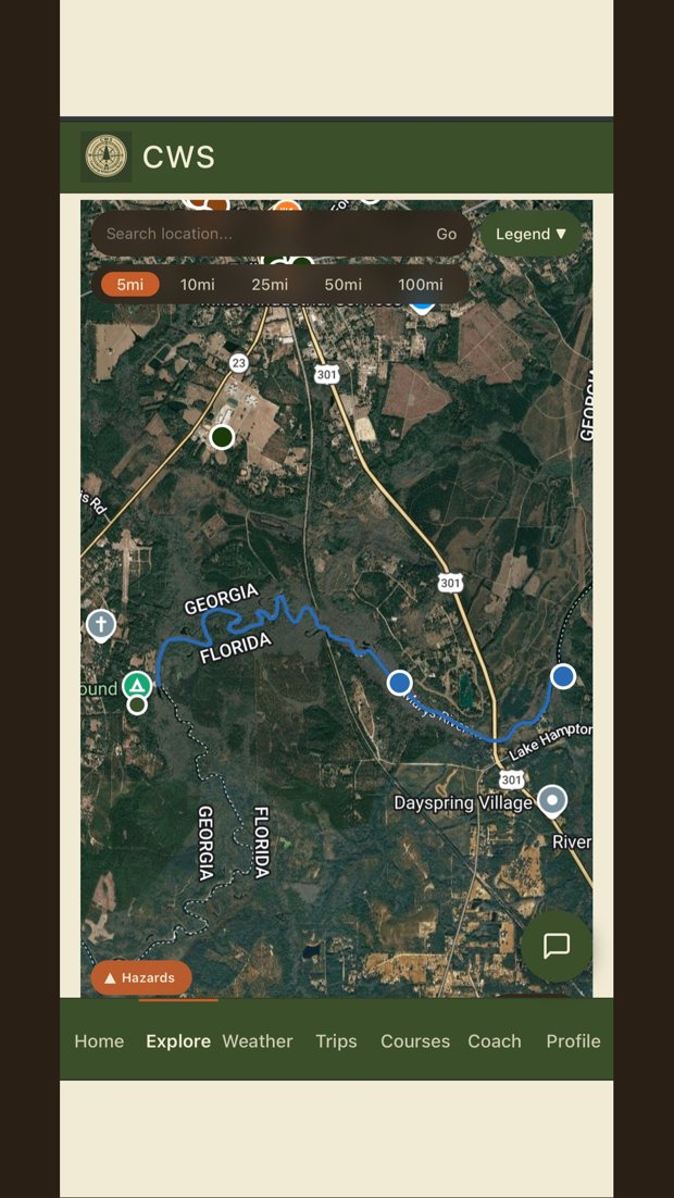
Download satellite and topographic maps before you leave the driveway, then track your route with waypoints and a live location dot, even with no cell service. Hazards and put-in/take-out points right on the map.

Offline satellite map with river route and waypoints
Live conditions

Weather every 15 minutes and live river gauges

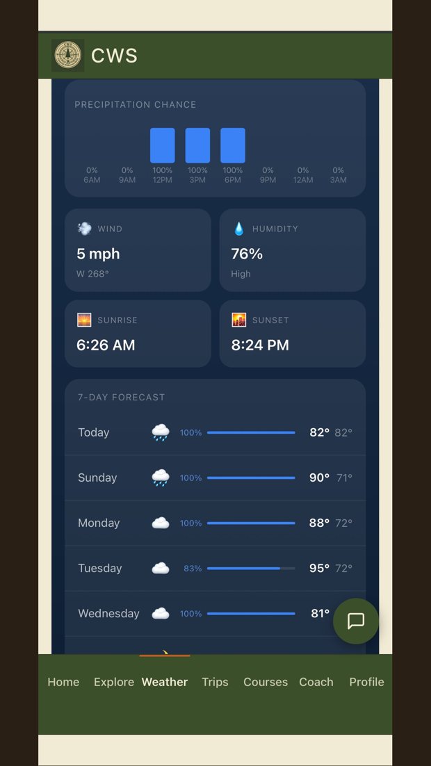
Forecasts refreshed every 15 minutes for your exact coordinates, plus live USGS streamflow and gauge data so paddlers know the water level before launch day. This is the data that decides whether you go.

Weather dashboard with 7-day forecast
Premium

The AI Coach, the experienced friend in your pocket

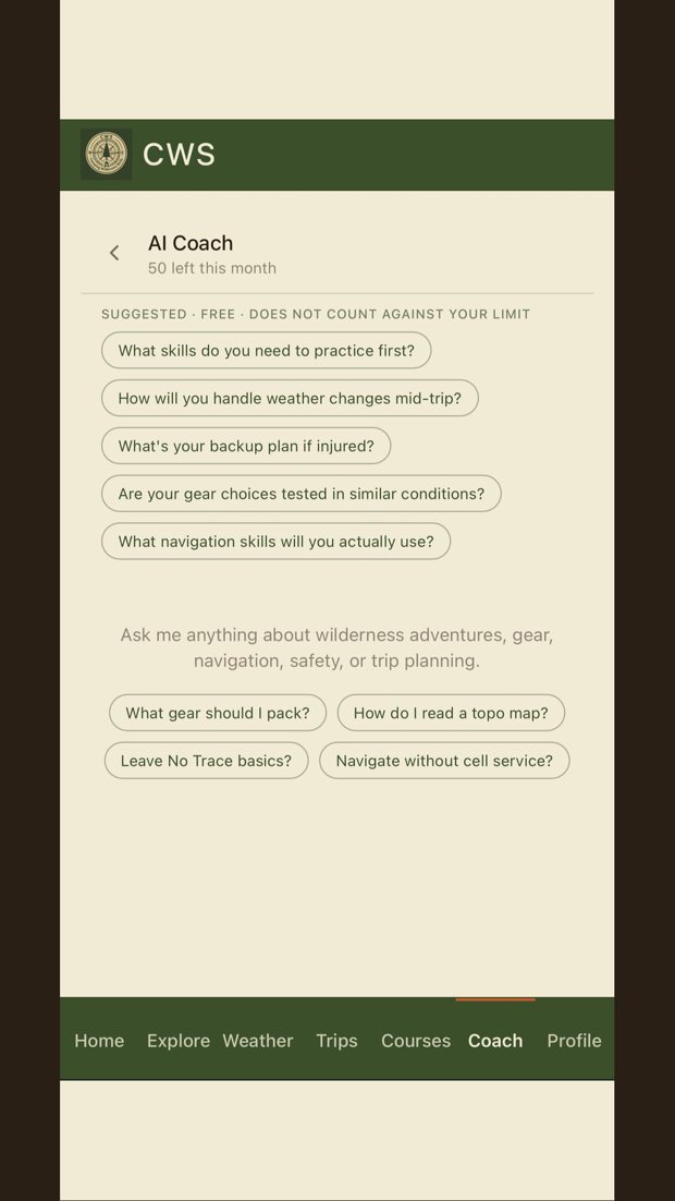
Premium unlocks an outdoor assistant that knows your route, your trip history, and the current conditions at your destination. Ask it about gear, water crossings, navigation, or contingencies, and get answers built for your specific trip.

AI Coach chat with suggested questions

Everything in the app

Offline maps

Satellite and topo maps downloaded for anywhere you go.

GPS tracking

Route lines, waypoints, and a you-dot that works with no signal.

Live weather

Refreshed every 15 minutes for your exact route.

USGS river gauges

Live streamflow and water-level data for paddlers.

Skill-gap trip plans

Personalized planning that knows what you still need to learn.

Gear checklists

Built for your trip type, exportable to PDF.

Safety check-in

Location sharing and an "I'm back safe" tap for your emergency contact.

AI Coach (Premium)

Advice for your specific route, gear, and conditions.

Free vs Premium

Free

$0
  • Plan your first trip
  • Maps, weather, and river gauges
  • GPS tracking and safety check-in

Premium

Included with CWS Premium
  • The AI Coach
  • Unlimited saved trip plans
  • Offline map downloads, any region
  • PDF trip reports to share
  • Plus the full course library and Field Manual
Go Premium

Privacy first: no ads, ever. Your location data is yours, and is never sold or shared with third parties.

How to get the app

The CWS app comes with your community membership, not a separate app-store subscription. Join THE CAMPFIRE and go Premium, and the full app unlocks for you on both iOS and Android.

Join THE CAMPFIRE to get the app

App questions, answered

What is the CWS app?

A trip-planning tool for hikers and paddlers. It builds a personalized plan from your route and experience, then backs it with offline maps, live weather, USGS river gauges, and GPS tracking that works when the signal dies.

How do I get it?

It's included with your CWS membership. Join THE CAMPFIRE free to get started, and the full app unlocks with Premium. There's no separate app-store subscription.

Does it work offline?

Yes. Maps download for offline use and GPS tracking works without cell service.

Does it have river gauge data?

Yes. It pulls live USGS streamflow and gauge data so paddlers can check levels before launch day.

What is the AI Coach?

A Premium outdoor assistant that knows your route, history, and current conditions, and answers questions built for your specific trip.

iOS and Android?

Both. No ads, and your location data is never sold.
Plan your next trip like you mean it.

Go Premium and get the full app, the course library, and the Field Manual, all in one membership.

Go Premium